International Disaster Risk Reduction Day: Leveraging GIS for a Safer Future
 0 min
0 minInternational Disaster Risk Reduction Day, celebrated every year on October 13th, emphasizes the critical need for proactive strategies to mitigate the effects of natural hazards. At Quarticle, we recognize the powerful role that Geographic Information Systems (GIS) can play in these efforts, providing essential tools to enhance disaster preparedness and response.
The Role of GIS in Disaster Risk Reduction
GIS empowers decision-makers with real-time data visualization, hazard mapping, and risk assessment tools. By integrating spatial data with predictive models, municipalities, businesses, and governments can identify vulnerabilities, optimize resource allocation, and design effective disaster response plans.
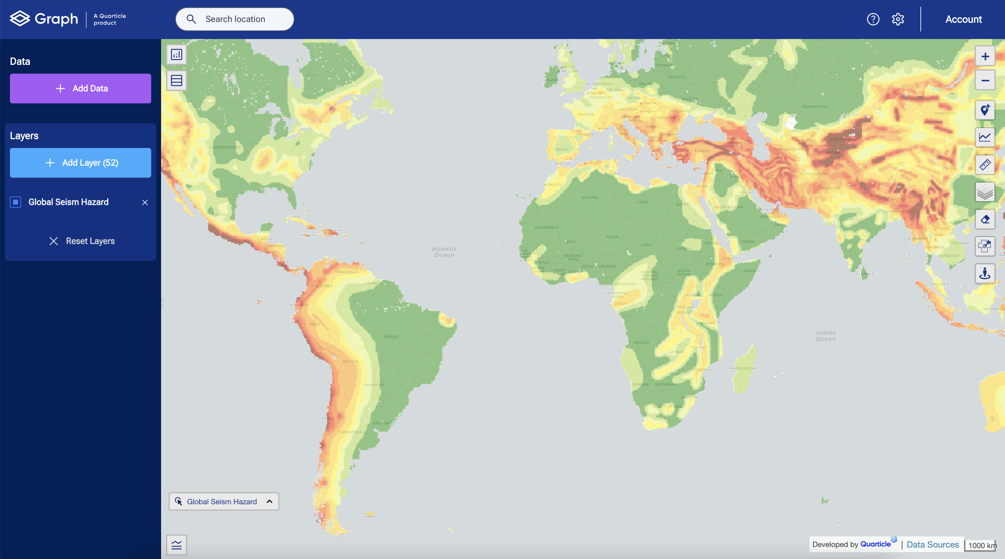
For example, GIS can be used to analyze topographic, climatic, and demographic data, helping planners understand which areas are most at risk of hazards like floods, earthquakes, or wildfires. In addition, GIS helps in creating simulations that predict potential impacts based on different disaster scenarios, enabling authorities to develop targeted mitigation strategies and improve resilience.

Source of the above layer: https://www.gfz-potsdam.de/en/gshap/
Flood-Prone Regions and GIS
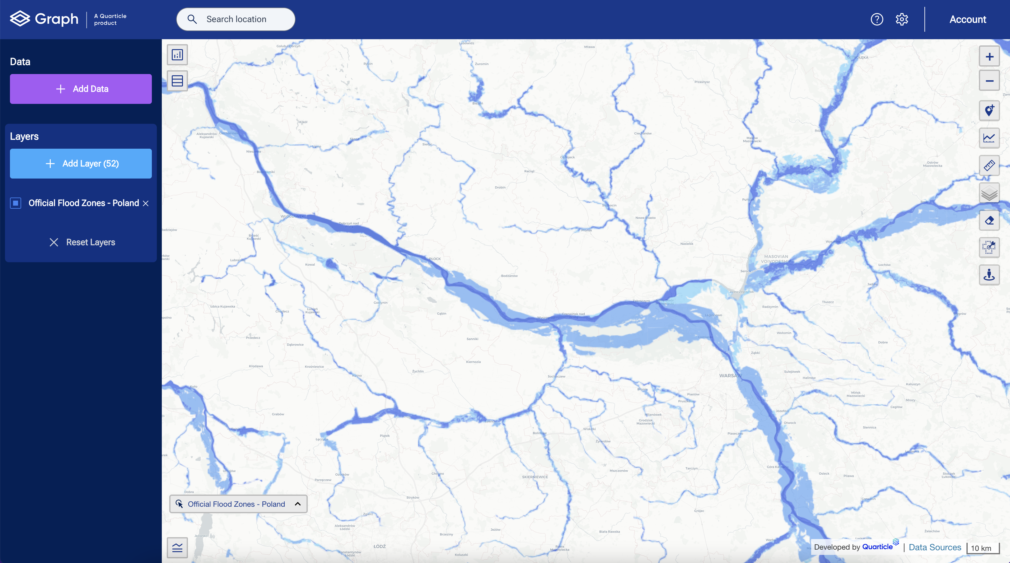
Floods are one of the most common and destructive natural disasters globally. GIS plays an indispensable role in flood risk management by helping communities and governments create detailed hazard maps that pinpoint flood-prone regions. By combining historical flood data with real-time weather information and terrain analysis, GIS allows authorities to better understand where floods are likely to occur and how severe they may be.
In addition to hazard mapping, GIS is crucial for tracking infrastructure vulnerabilities, such as weak points in drainage systems. These insights enable communities to strengthen critical infrastructure before disaster strikes. In addition, early warning systems that rely on GIS can improve emergency response times by predicting where floods will hit hardest, ensuring that vulnerable populations are evacuated in time.
After the floods, GIS facilitates recovery efforts by mapping out areas that have been affected and assessing the damage to roads, bridges, and utilities. This allows for a more organized and efficient recovery process, saving time and resources.

Flood Layer in Graph by Quarticle
GIS in the Era of Climate Change
With climate change amplifying the frequency and severity of natural disasters, the ability to analyze spatial data and predict risks has never been more critical. Rising global temperatures lead to more intense storms, prolonged droughts, and increased flooding in coastal areas. GIS helps communities prepare for these risks by enabling more precise environmental monitoring and forecasting.
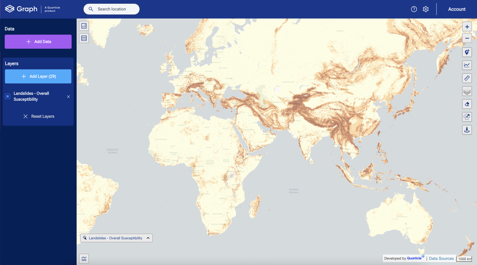
For instance, coastal cities can use GIS to study rising sea levels, mapping out zones that may soon become uninhabitable and planning accordingly to prevent future displacement. In regions prone to landslides, GIS helps to analyze rainfall patterns, soil moisture levels, and crop health.

Source of layer: https://datacatalog.worldbank.org/search/dataset/0037584
Embracing GIS for Disaster Resilience
As disasters become more frequent and intense, governments, businesses, and organizations must adopt innovative tools like GIS to protect communities and minimize damages. By providing detailed, real-time insights, GIS allows for smarter, more precise disaster planning and response.
On this International Disaster Risk Reduction Day, let’s commit to leveraging technology to better protect our world from natural hazards. GIS is not just a tool for crisis response—it’s an investment in resilience, helping communities recover faster, adapt more effectively, and thrive in the face of future challenges.
To learn more about how Quarticle’s GIS solutions can contribute to disaster resilience and help you prepare for the unexpected, reach out at [email protected].