
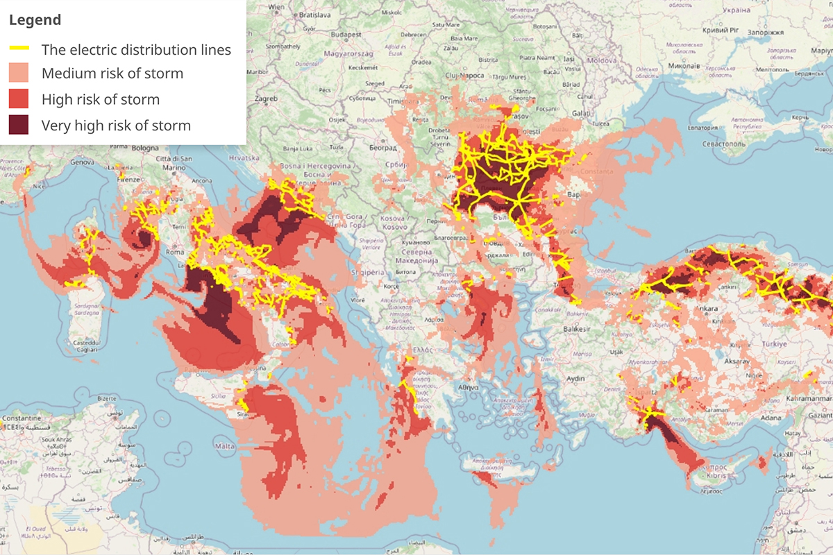
Using severe weather predictions to forecast power lines damages
Almost all of our day-to-day activities heavily depend on electricity and power usage, from telecommunications and transportation to different forms of entertainment and leisure activities. However, the electricity supply can be unexpectedly interrupted by

Understanding Formats and Coordinates in Geospatial Data
The smooth integration of geographic information in applications such as Google Maps and the precise calculations powering GPS systems highlight the significant advancements made in the field. However, understanding the various geospatial data formats and coordinates remains a complex task.
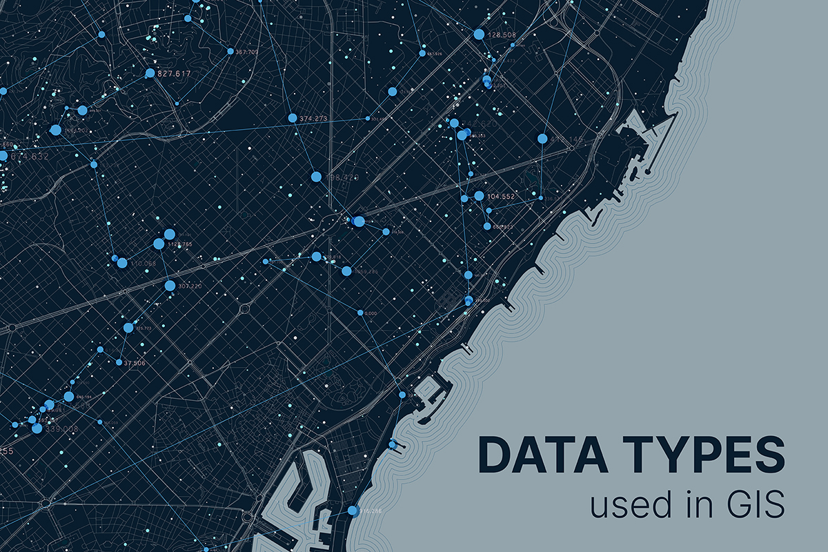
A Comprehensive Guide for Commonly Used GIS Data Types
As GIS continues to evolve, the use of various data types becomes increasingly critical for effective spatial analysis and decision-making. Understanding the characteristics, strengths, and applications of commonly used GIS data types empowers professionals across diverse industries to leverage geospatial data to its fullest potential.

Geospatial AI and Machine Learning: The Key to Smarter Business Strategies
The rapid evolution of geospatial technology has brought forth a transformative era where Geospatial AI and Machine Learning in mapping are reshaping how businesses and organizations analyze spatial data. Today, GIS solution providers empower clients with spatial machine learning models and predictive spatial analytics to tackle complex challenges, optimize operations, and extract meaningful insights.
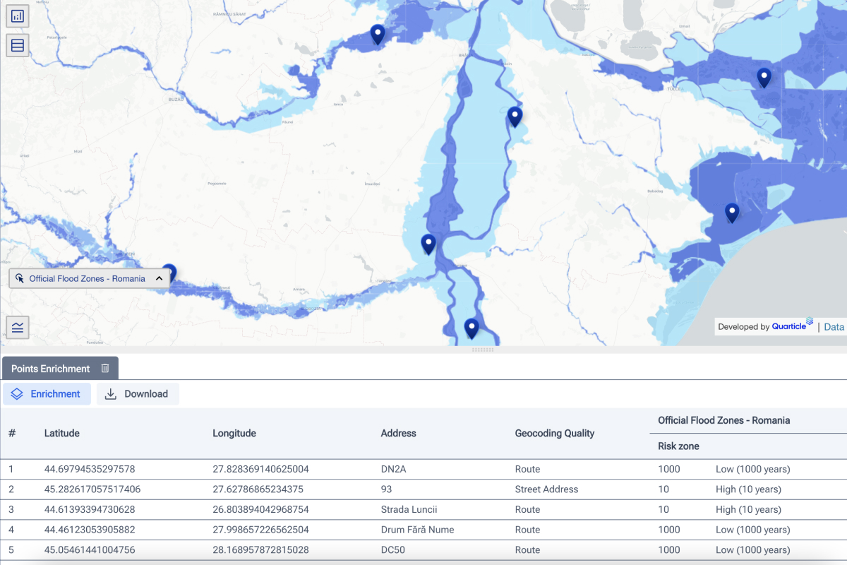
The Cost of Subjectivity: Why Accurate Risk Assessment Is Critical for Insurers
Risk assessment in the insurance and reinsurance industry should be rational and objective. However, human biases, emotions, and subjectivity can unintentionally skew assessments, leading to inaccurate risk evaluations. This results in mispriced policies, inefficient capital allocation, and financial losses.